«When I applied to the MediaLab's internship program, I was very interested in working on projects that aim to enhance the museum experience. The Met is one of the most visited museums in the world, and it's so big that even staff with years of experience can sometimes feel lost. With these two things in mind, I focused on building on one of the wayfinding projects completed during the previous semester.»
The project was started by a group of students from the Design and Technology Program at Parsons The New School and initially focused on accessibility. It was later picked up by Yuliya Parshina-Kottas, a former MediaLab intern, and I started from where she left off. During her semester, Yuliya worked on creating an algorithm to calculate the fastest path from one point in the Museum to another, the results of which would then be displayed on a webpage designed for desktop browsers.
My goal was to transform this work into a mobile experience. I wanted to come up with something that was more than just a map, so I initially focused on creating a mobile application that would guide the visitor to their destination every step of the way. I partnered with Xinyi Deng, and we decided to split the project in two parts: algorithm and user experience. Xinyi worked on porting the algorithm to mobile, and I was in charge of user experience, interface design, and user research.
Research, UX, and UI
To begin, we came up with several questions that we wanted to answer:
- How do we introduce the idea of wandering into wayfinding? How can we display this navigation information?
- Given two points in the Museum, what's the shortest path that avoids stairs and/or low-lit rooms?
- What if the user has thirty minutes and would like to be guided by a curator, taking the quickest route through the most popular galleries?
Based on these questions, we started molding the mobile experience into four different service types:
- Full Map: A digital version of the map that is not interactive and only allows the user to zoom in and out.
- From One Point to Another: A function that provides the fastest path from one gallery to another.
- Guided Tour: A function that takes time constraints and interest in a specific area into account. For example, this option is ideal for user that wants to see the best of Chinese art in thirty minutes.
- Full Visit: A function that provides the best path through the entire Museum, gallery by gallery, from a designated starting point.
We designed several iterations to address these concepts, and after receiving some feedback, we decided to focus on what we considered the most important feature: "From One Point to Another." We also found that we didn't have enough time to include any emerging technologies that utilize indoor-user localization in this project because we would need to focus exclusively on testing these technologies in order to understand which one would work better and how.
Other Museum Solutions
In our research, we looked at the wayfinding functionality found in the mobile app of other museums.
Museum of Modern Art (MoMA)
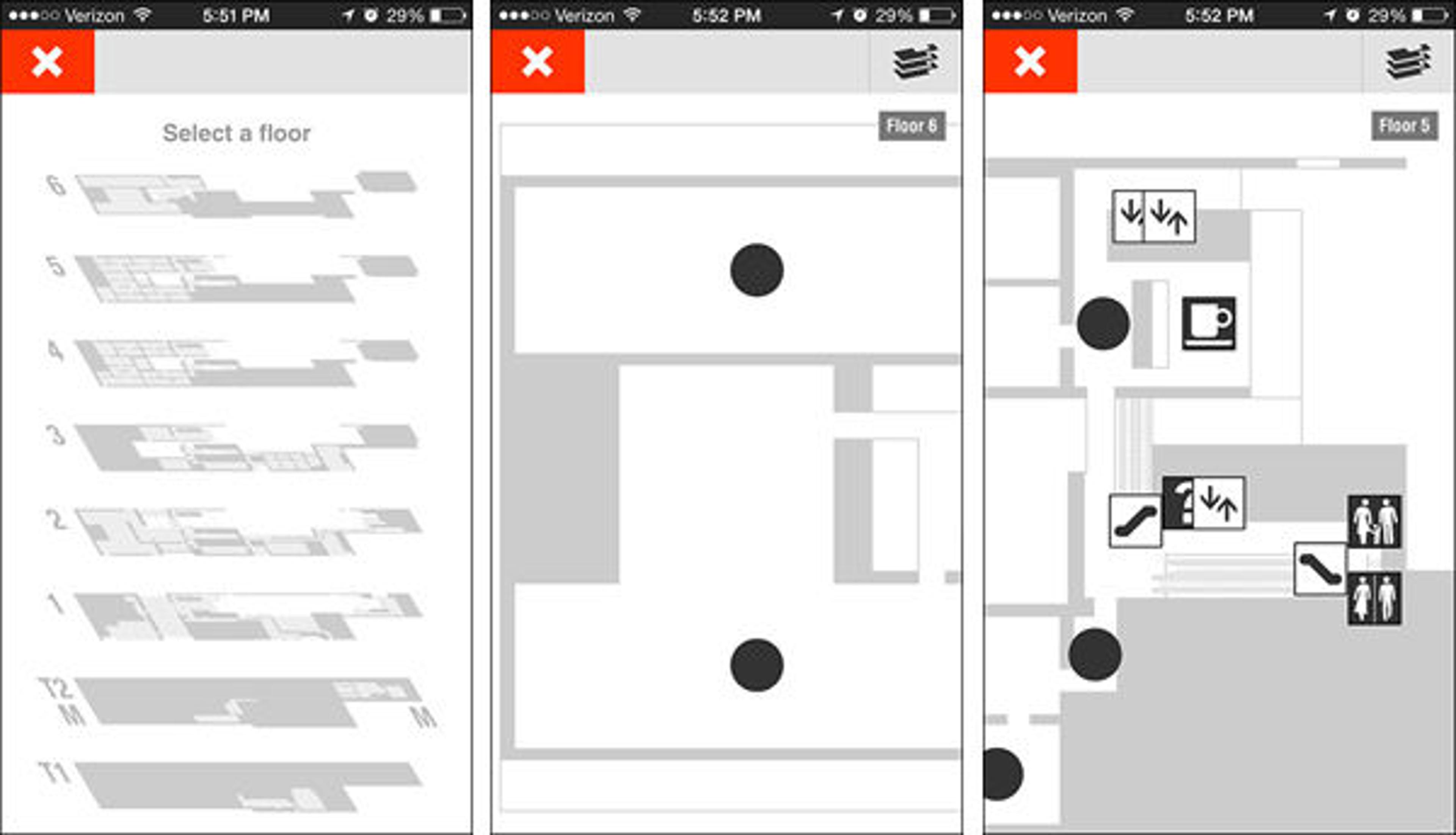
Screenshots of the MoMA app's map functions
The Museum of Modern Art's app gives users the option to select a floor and zoom in and out, but it's not interactive and the user can't fully explore all of the galleries or navigate between them.
Solomon R. Guggenheim Museum
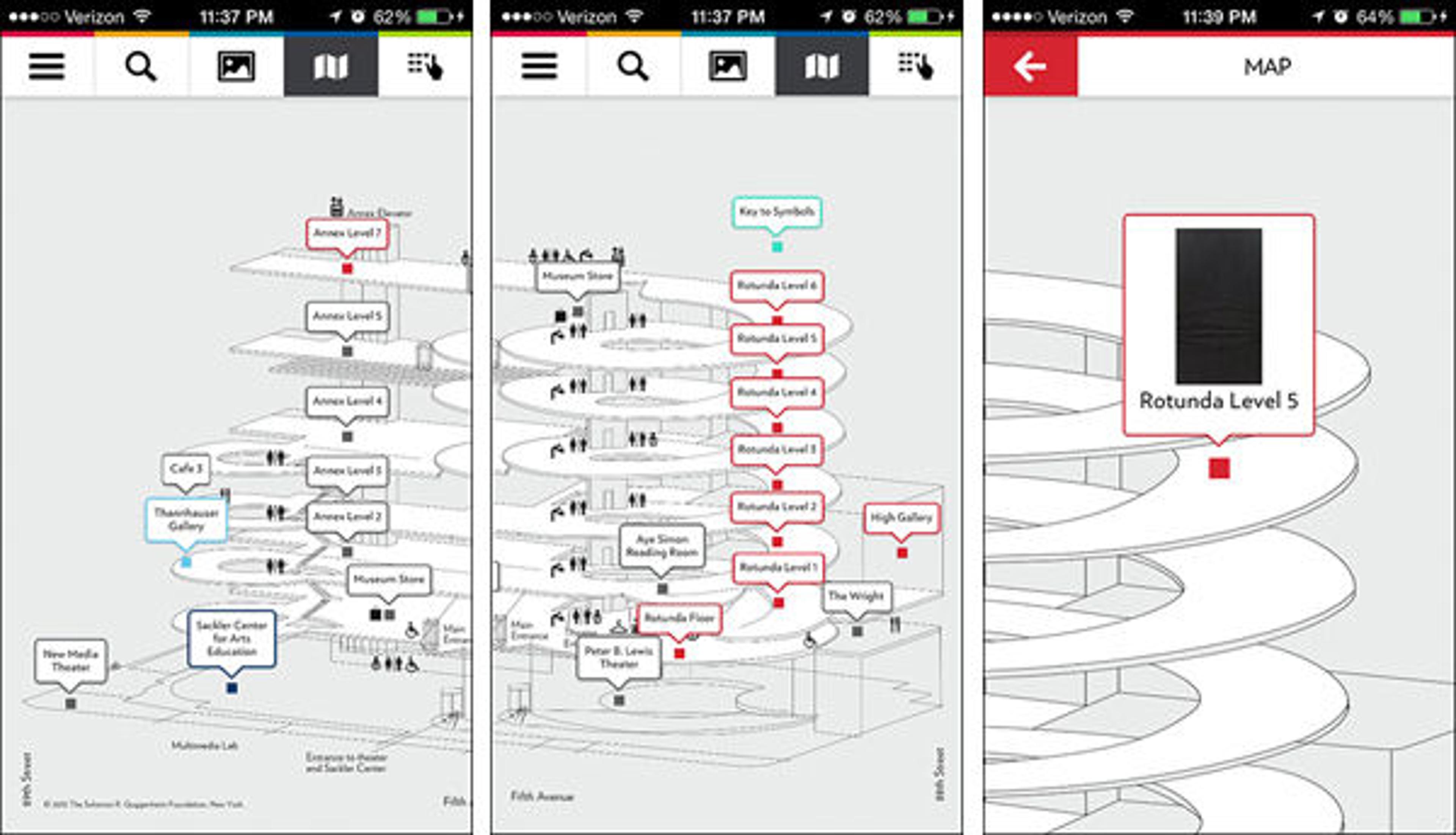
Screenshots of the Guggenheim app's 3D map (left, center) and a selected location (right)
The Guggenheim's app uses a 3D map to show users how each of the floors connect and where everything is located. While the building's architecture makes this feature very interesting, the way the map displays the locations of the different galleries and artworks isn't very interactive.
Victoria and Albert Museum
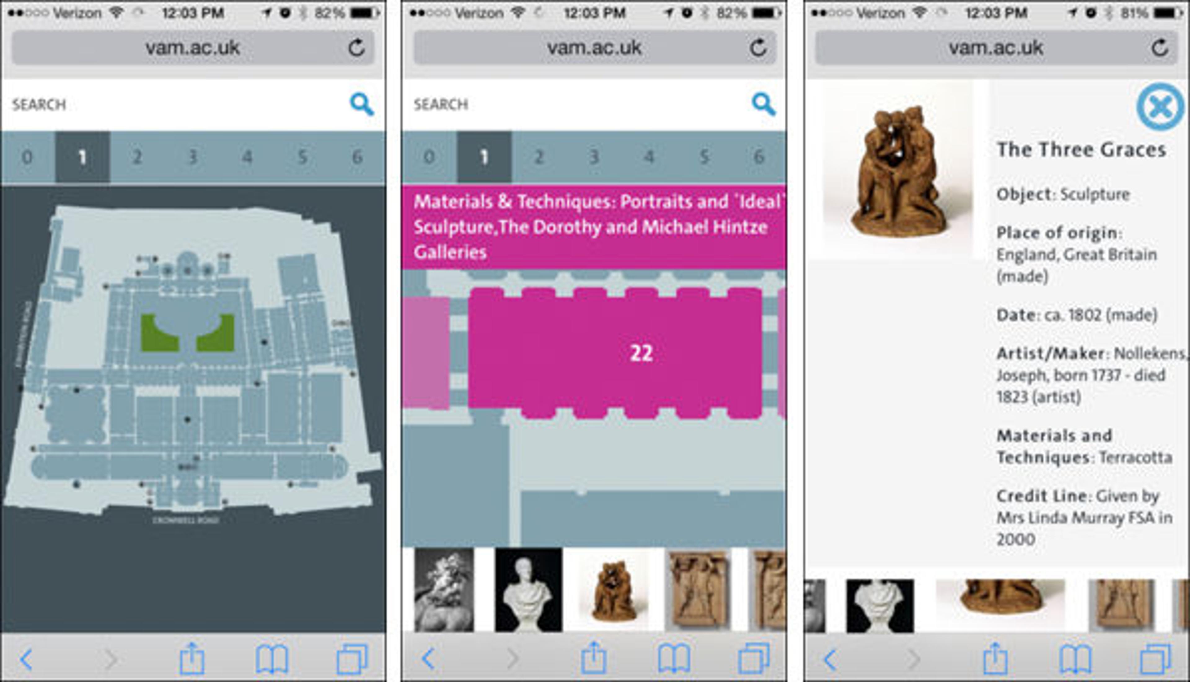
Screenshots of the map found on Victoria and Albert Museum's mobile website (left), a selected gallery (center), and information about an artwork (right)
The version of the Victoria and Albert Museum map found on their mobile website allows users to select a gallery, zoom in and out on the gallery, and read about some of the artworks in the selected gallery.
A Different Approach
We then studied the way the Google Maps app provides step-by-step guidance, since we thought that this might be the most effective function to include in our map. With Google Maps, the user first inputs their starting location and then their destination. The app calculates the best route and gives the user a map of the route, a list of the steps the user needs to take to get to their destination, and step-by-step guidance.
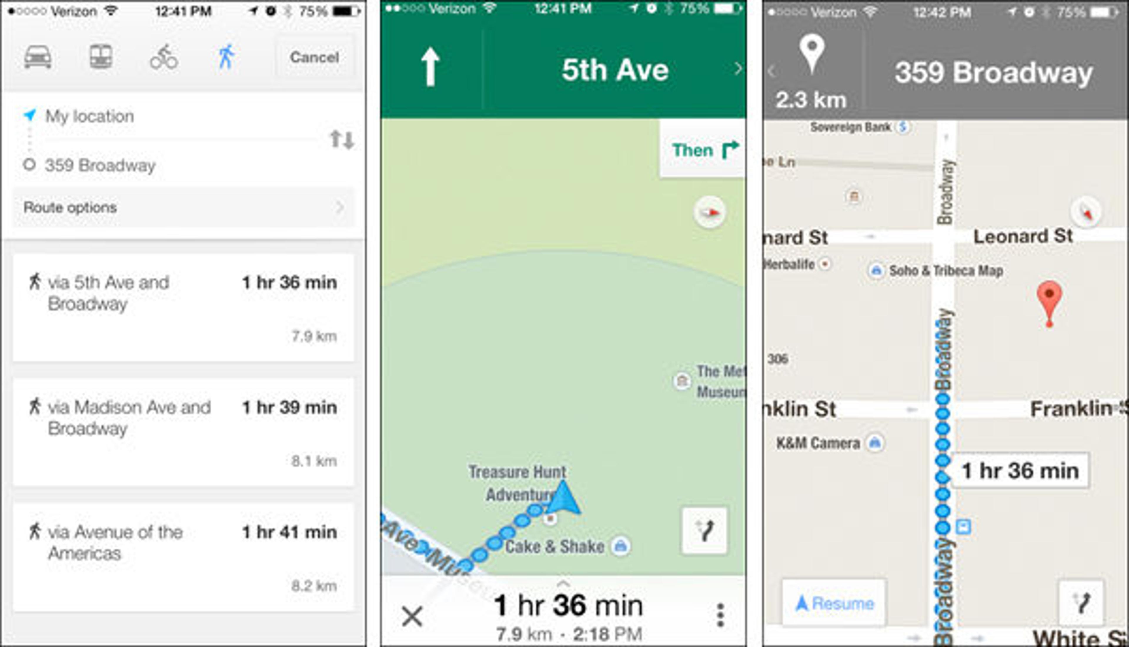
Screenshots of the Google Maps app providing different routes (left) and step-by-step guidance (center, right)
We also considered using the Audio Guide for visitors who want to pay attention to the art without having to look at their phone for guidance.
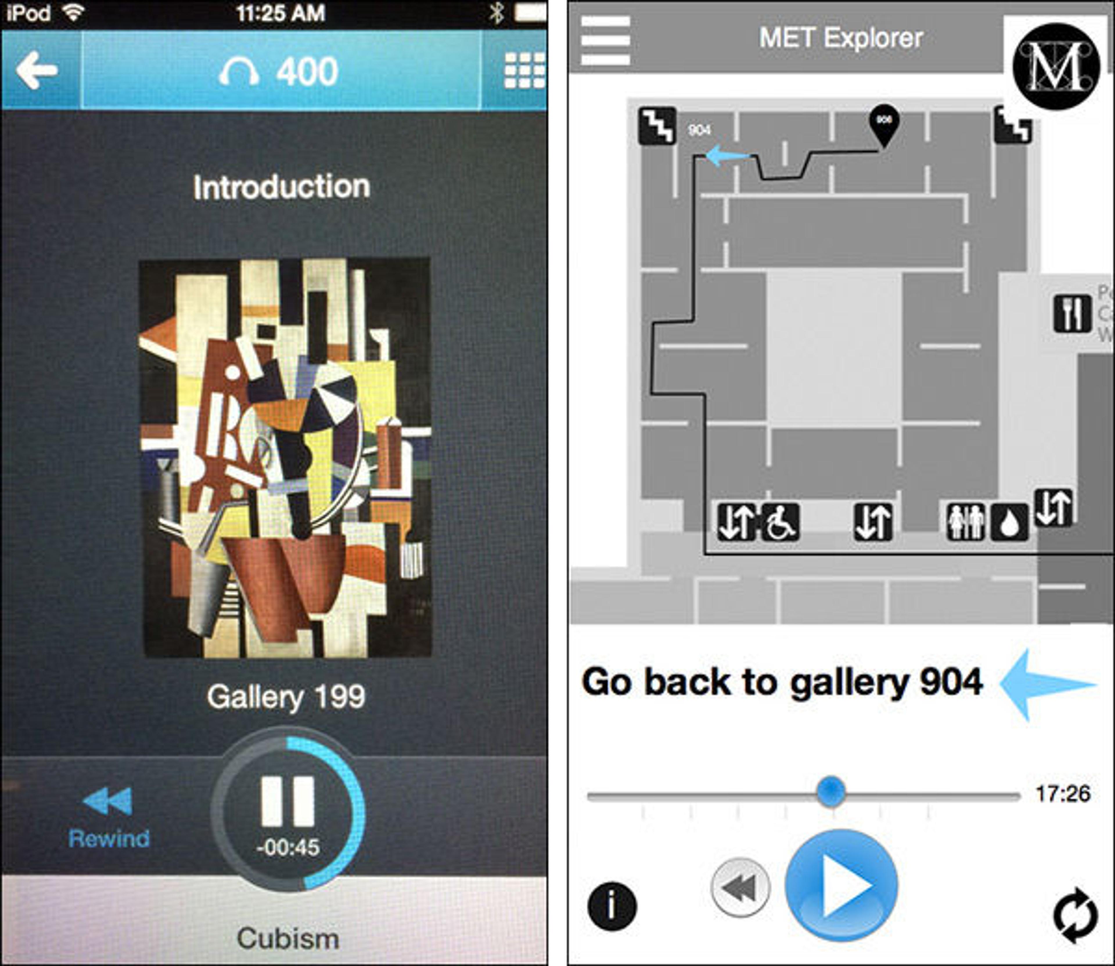
Screenshots of the Audio Guide (left) and a screenshot of a possible prototype inspired by the Audio Guide (right)
Creating a Prototype
After some research, conversations with Met staff, and further experimentation, we started to work on a first set of wireframes (shown below).
Screenshots of the first set of wireframes for the prototype
We then made a prototype and asked for feedback, and the feedback we received helped us create the next version of wireframes and the final prototype.
Final Prototype
From the first idea to the final product, we had to sacrifice several features and focus on what we thought was most important in order to keep the experience simple.
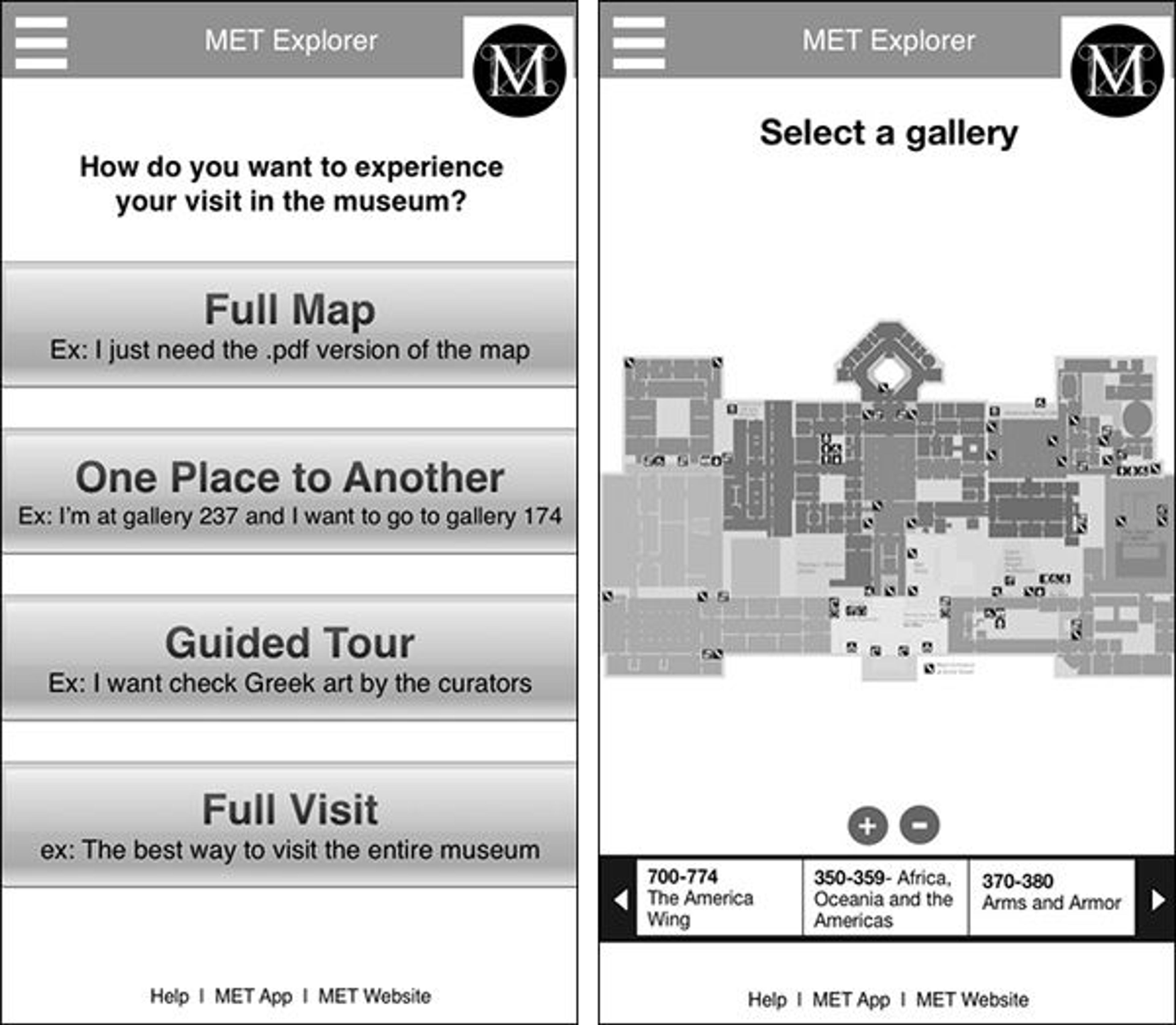
Our first idea was to build an app, but we couldn't deliver that in such a limited amount of time, so we produced a smart prototype that emulates the app experience on a mobile website.
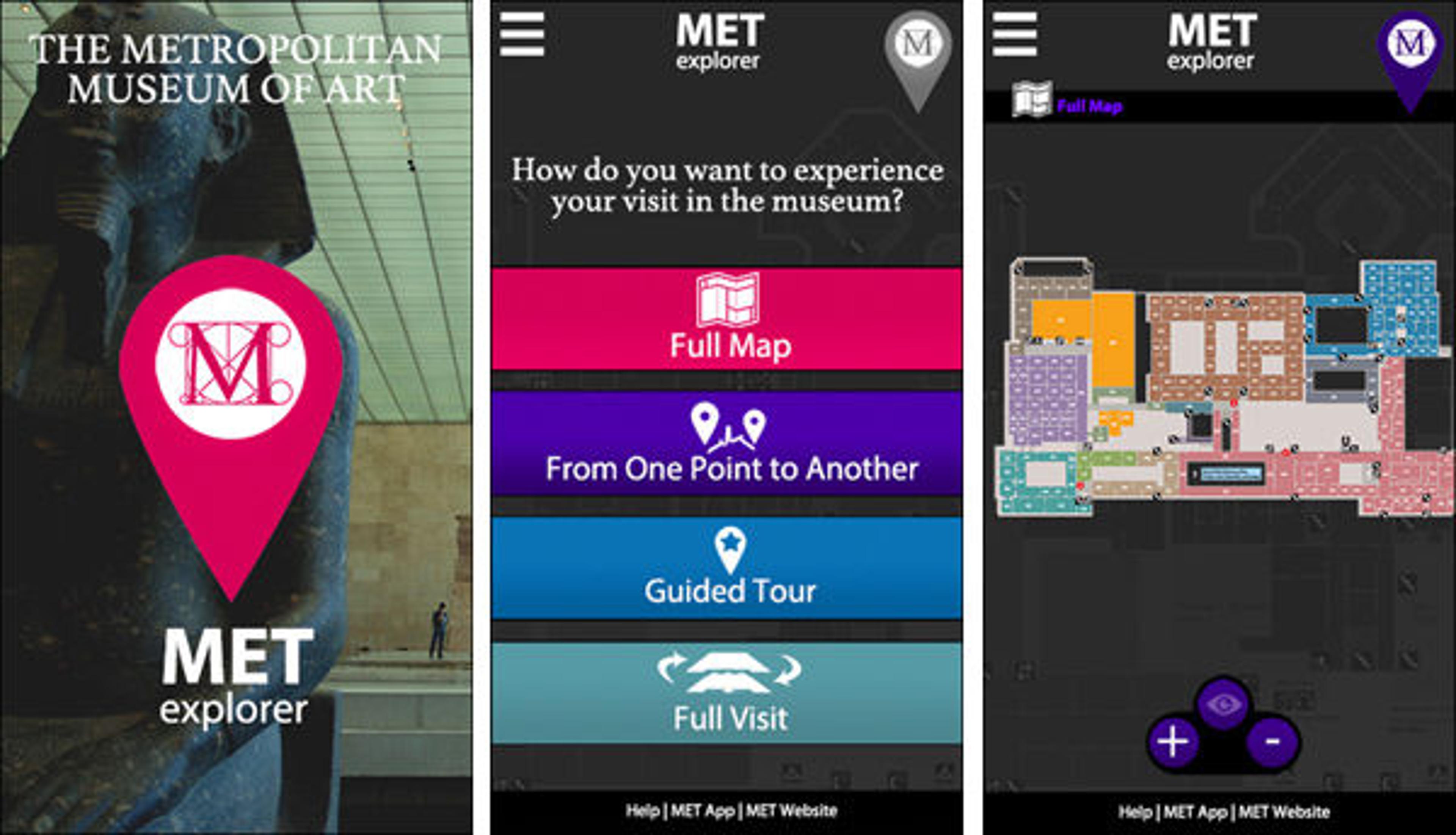
Screenshots of the prototype's start-up screen (left), main menu (center), and full map function (right)
The app's main menu lists the four different user types we previously described, from the simplest ("Full Map") to the most complex ("Full Visit"). Choosing "Full Map" gives the user access to a map of each floor on which they can zoom in and out. Zooming in on specific galleries allows the user to see the photographs and tombstone information of any artwork on view in that gallery.
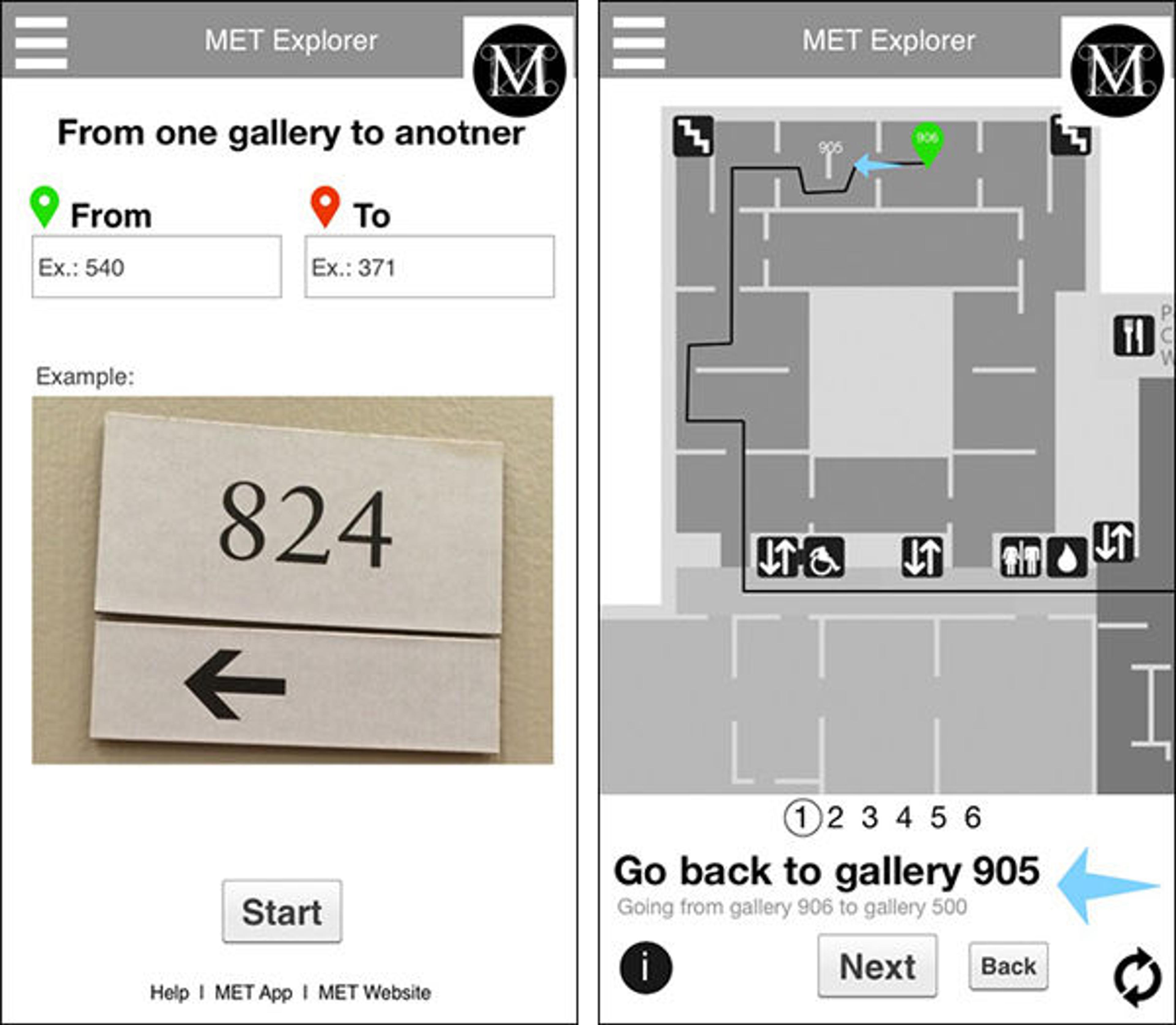
When the user selects "From One Point to Another," they are directed to input their start and end points. Once they click start, the app will provide an overview of the route on the map from beginning to end. One handy feature is the ability to choose various routes that avoid crowds, stairs, or both, changes that can impact the route's length and duration.
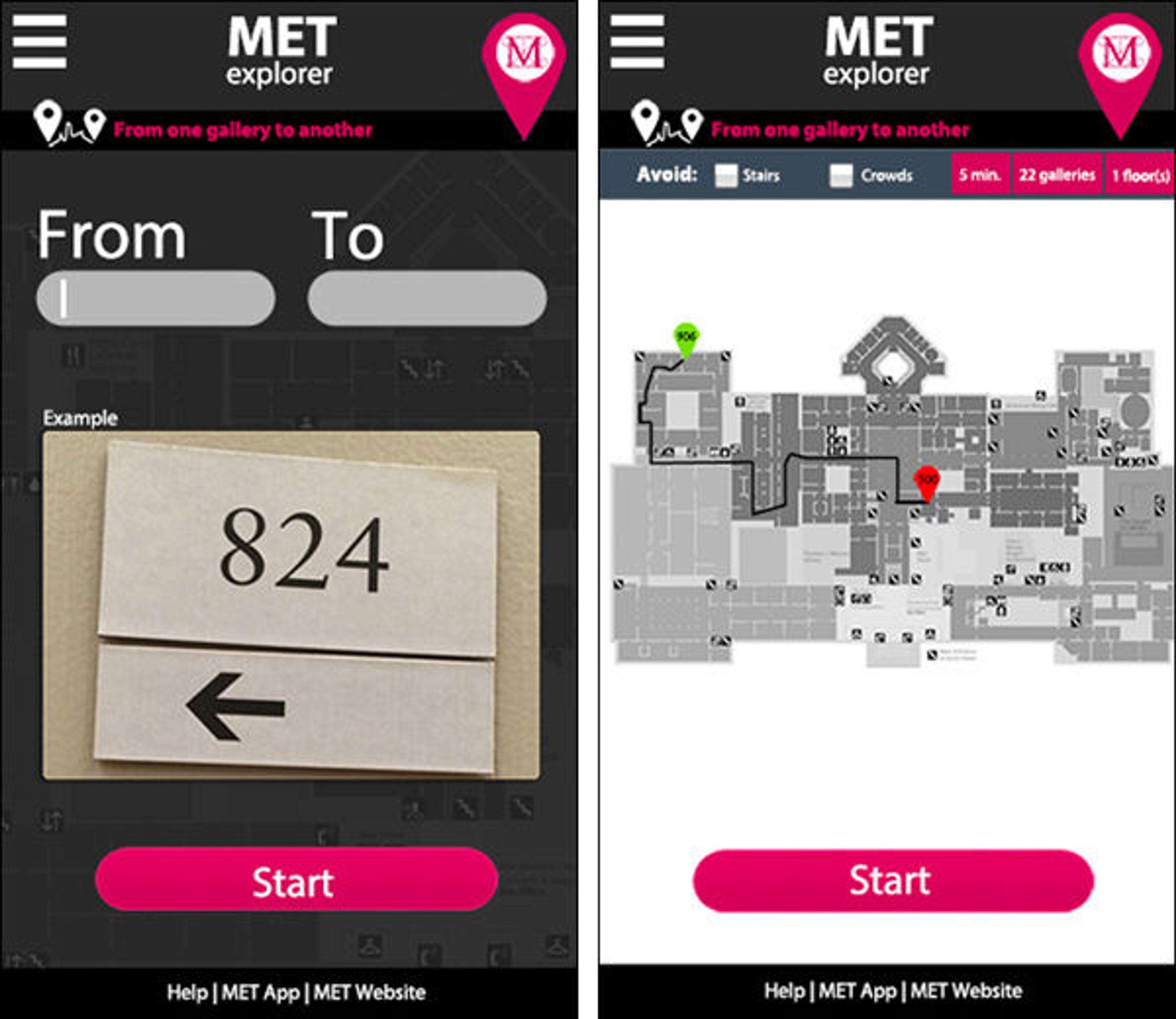
Screenshots of the "From One Gallery to Another" process
Once the user arrives at their destination, a restart button appears and the user can navigate back to the main menu.
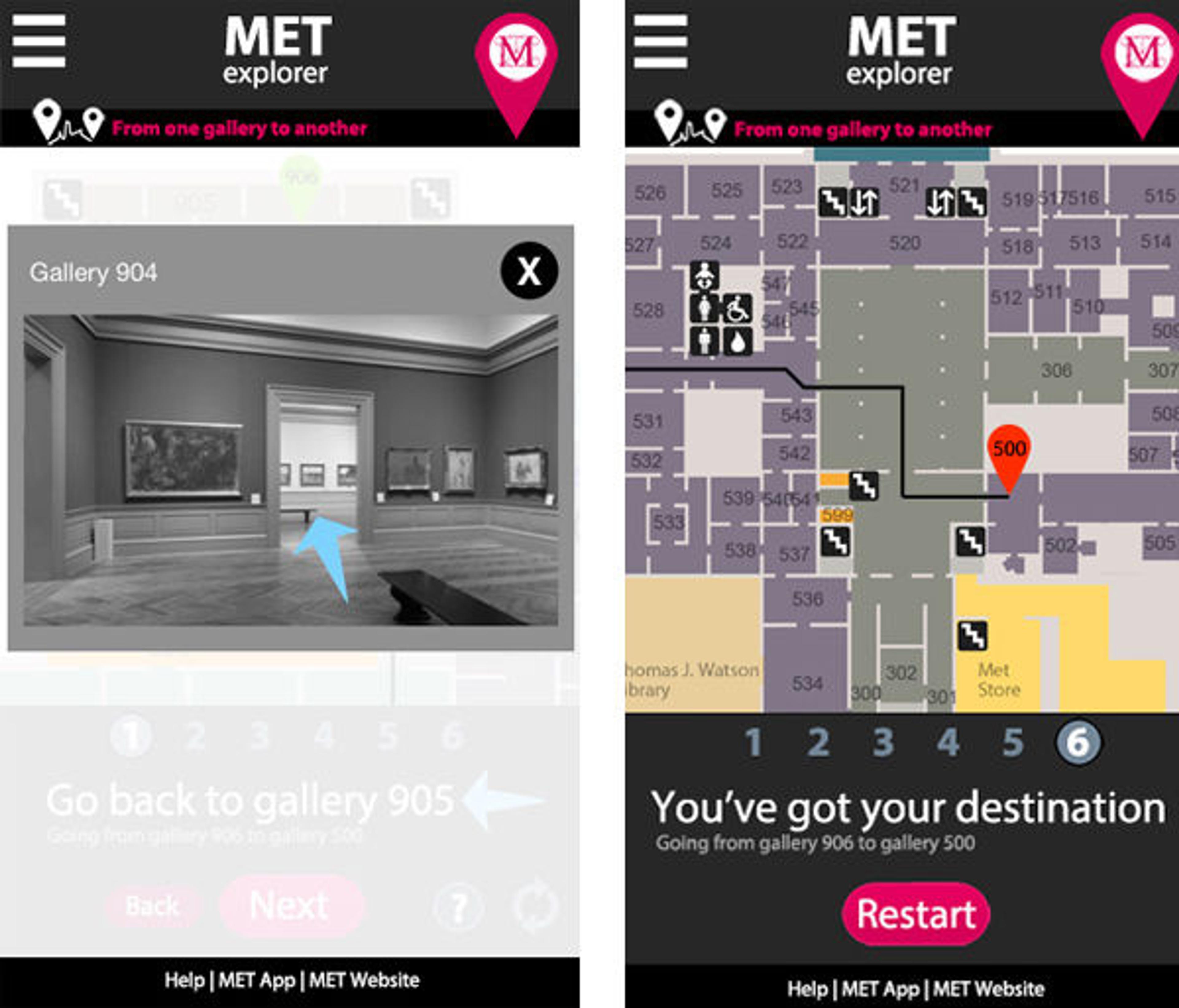
Screenshots of "From One Gallery to Another" step-by-step guidance (left) and "You've got your destination" screen (right)
We also added other special features to make the experience easier. Guidance mode allows the user to skip to the next step, view details about a specific step, get help, or restart the navigation. For rooms with multiple doors, we created a help button that displays pictures of each selected door to help the user find the one they are looking for.
Next Steps and Final Thoughts
This project has built upon the previous wayfinding algorithm project, and we believe it can be easily picked up and taken a step further by our successors. There is quite a bit of work to be done before this project can become a real product for Museum visitors. Next steps should include an extensive user-testing period for the prototype we created, and the project can be taken a few steps further by adding the option to use the name of the gallery or artwork as a destination, or creating an audio version.
Working on this project has been a very interesting and rewarding journey. We have brought it one step closer to a final product, and I hope that it keeps evolving so that maybe one day I can use it to navigate the Museum as a visitor!