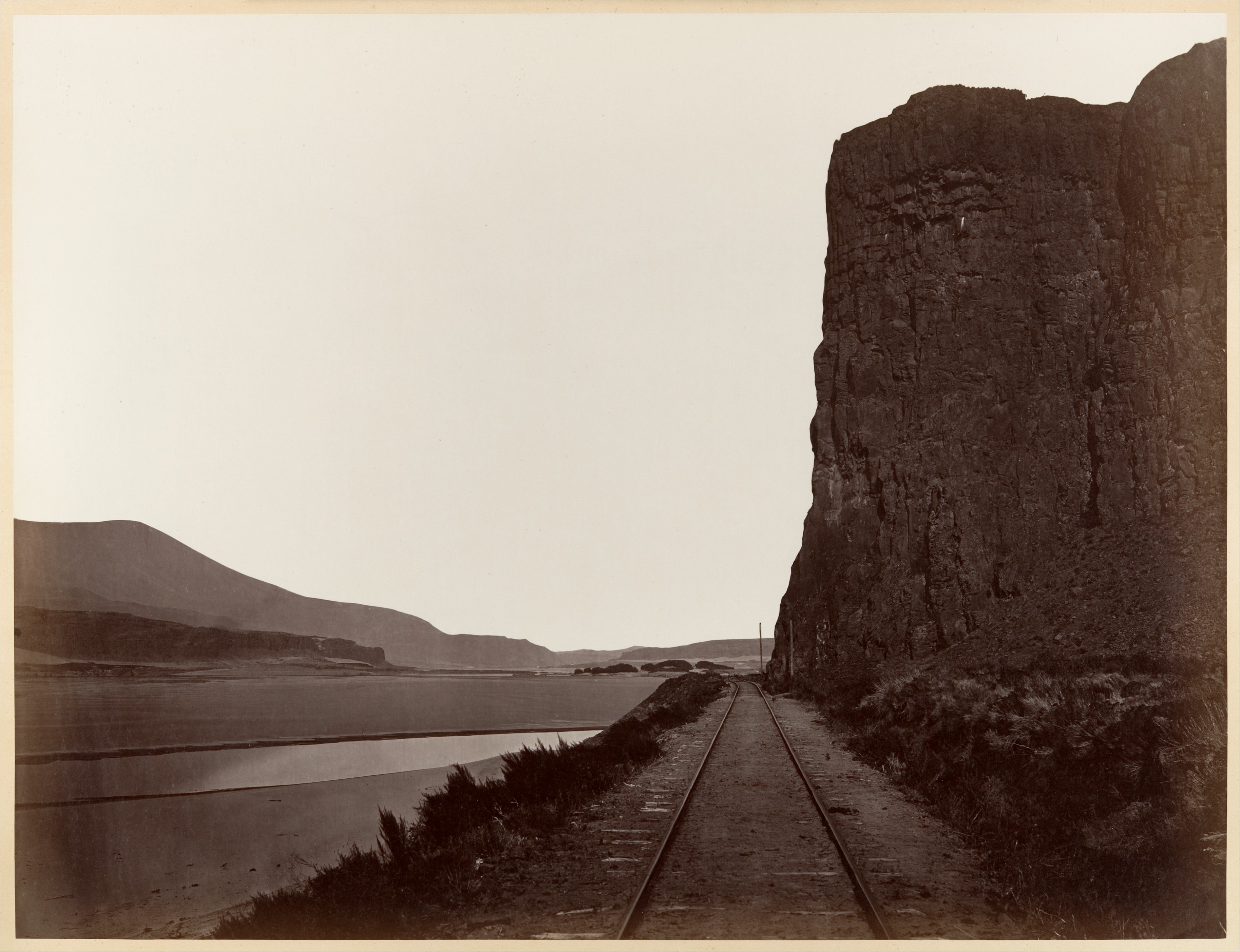
When Watkins traveled up the Columbia River, he photographed both the natural and manmade landmarks-the rocky outcrops and cascades, and the small towns, mills, and docks along the way. His path followed that of the Oregon Steam Navigation Company, and as he photographed not only the company's route but also its facilities, he may have been working either on commission or with a speculative eye for the company's business. One hundred miles upstream from Portland, Celilo was the farthest reach of Watkins' travels during the four-month excursion. It would be easy to surmise that the centrality of the rails in this photograph is evidence of Watkins' business agenda. But in the absence of confirming data, one might instead interpret the picture as a visual metaphor for Manifest Destiny, the belief that the United States was destined to span the continent with its sovereignty. The artful balance Watkins achieves between nature and man's incursion into nature-between the valley etched in the land by the river and the railroad laid down alongside it-suggests that whether he saw Cape Horn as a commercial opportunity or as a symbolic representation of a national doctrine, he also recognized it as a providential place of aesthetic and moral harmony that provided the opportunity for a pictorial expression of a perfect state of grace.
Due to rights restrictions, this image cannot be enlarged, viewed at full screen, or downloaded.
Open Access
As part of the Met's Open Access policy, you can freely copy, modify and distribute this image, even for commercial purposes.
API
Public domain data for this object can also be accessed using the Met's Open Access API.
Use your arrow keys to navigate the tabs below, and your tab key to choose an item
Title:Cape Horn near Celilo
Artist:Carleton E. Watkins (American, 1829–1916)
Date:1867
Medium:Albumen silver print from glass negative
Dimensions:Image: 40 x 52.4cm (15 3/4 x 20 5/8in.) Mount: 54.5 x 68.6 cm (21 7/16 x 27 in.)
Classification:Photographs
Credit Line:Gilman Collection, Purchase, The Horace W. Goldsmith Foundation Gift, through Joyce and Robert Menschel, 2005
Accession Number:2005.100.109
Inscription: Inscribed in ink on mount, recto BC: "Cape Horn // near Celilo"; inscribed in pencil on mount, recto BR: "44"
University Club, New York; San Francisco Mercantile Library; (sold, Swann Auction Galleries, New York, May 10, 1979); [Weston Gallery]; Gilman Paper Company Collection, New York, May 25, 1979
Friends of Photography, Carmel. "Photographs from the Columbia River and Oregon," February 15, 1980–March 10, 1980.
Amon Carter Museum of American Art. "Carleton E. Watkins: Photographer of the American West," April 1, 1983–May 22, 1983.
Museum of Fine Arts, Boston. "Carleton E. Watkins: Photographer of the American West," June 15, 1983–August 14, 1983.
Saint Louis Art Museum. "Carleton E. Watkins: Photographer of the American West," September 15, 1983–October 30, 1983.
Oakland Museum of California. "Carleton E. Watkins: Photographer of the American West," December 16, 1983–February 19, 1984.
Palais de Tokyo, Paris. "Procédés, Procédés," October 7, 1987–November 30, 1987.
National Gallery of Art, Washington D.C. "On the Art of Fixing a Shadow: One Hundred and Fifty Years of Photography," May 7, 1989–July 30, 1989.
Art Institute of Chicago. "On the Art of Fixing a Shadow: One Hundred and Fifty Years of Photography," September 16, 1989–November 26, 1989.
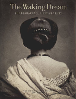
The Metropolitan Museum of Art. "The Waking Dream: Photography's First Century, Selections from the Gilman Paper Company Collection," May 25–July 4, 1993.
Edinburgh International Festival, Edinburgh, Scotland. "The Waking Dream: Photography's First Century, Selections from the Gilman Paper Company Collection," August 7–October 2, 1993.
National Gallery of Art, Washington D.C. "The Waking Dream: Photography's First Century, Selections from the Gilman Paper Company Collection," June 19–September 11, 1994.
Carrousel du Louvre, Paris. "Constructed Views: Photography and Architecture," November 19, 1998–November 23, 1998.
San Francisco Museum of Modern Art. "Carleton Watkins: The Art of Perception," May 28–September 7, 1999.
The Metropolitan Museum of Art. "Carleton Watkins: The Art of Perception," October 11, 1999–January 9, 2000.
National Gallery of Art, Washington D.C. "Carleton Watkins: The Art of Perception," February 20–May 7, 2000.
The Metropolitan Museum of Art. "Johnson Gallery, Selections from the Collection 40," April 19–July 10, 2005.
Museum of Fine Arts, Houston. "The Modern West: American Landscapes, 1890-1950," October 29, 2006–January 28, 2007.
The Metropolitan Museum of Art. "Framing a Century: Master Photographers, 1840–1940," June 3–September 1, 2008.
Naef, Weston J., and James Wood. Era of Exploration: The Rise of Landscape Photography in the American West, 1860–1885. Buffalo: Albright-Knox Art Gallery, 1975. no. 29.
Watkins, Carleton E. Photographs of the Columbia River and Oregon, edited by James Alinder. Carmel, Calif.: Friends of Photography, Carmel, 1980. no. 44.
Palmquist, Peter E. Carleton Watkins: Photographer of the American West. Albuquerque: Amon Carter Museum of American Art, 1983. pl. 34.
Apraxine, Pierre. Photographs from the Collection of the Gilman Paper Company. Reeds Springs, Mo.: White Oak Press, 1985. p. 450, pl. 115.
Greenough, Sarah. On the Art of Fixing a Shadow: One Hundred and Fifty Years of Photography. 1st ed. Washington, D.C.: National Gallery of Art, Washington D.C., 1989. p. 122.
Hambourg, Maria Morris, Pierre Apraxine, Malcolm Daniel, Virginia Heckert, and Jeff L. Rosenheim. The Waking Dream: Photography's First Century, Selections from the Gilman Paper Company Collection. New York: The Metropolitan Museum of Art, 1993. nos. 122, 159, p. 328.
Nickel, Douglas R. Carleton Watkins: The Art of Perception. San Francisco: The Metropolitan Museum of Art, 1999. no. 56, p. 224, pl. 71.
The Metropolitan Museum of Art Guide. New York: The Metropolitan Museum of Art, 2012. p. 440.
The Met's Libraries and Research Centers provide unparalleled resources for research and welcome an international community of students and scholars.
The Met Collection API is where all makers, creators, researchers, and dreamers can connect to the most up-to-date data and public domain images for The Met collection. Open Access data and public domain images are available for unrestricted commercial and noncommercial use without permission or fee.
Feedback
We continue to research and examine historical and cultural context for objects in The Met collection. If you have comments or questions about this object record, please complete and submit this form. The Museum looks forward to receiving your comments.
The Met's Department of Photographs houses a collection of more than 75,000 works spanning the history of photography from its invention in the 1830s to the present.


